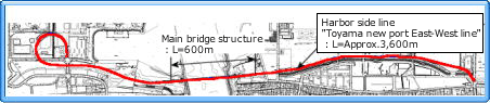
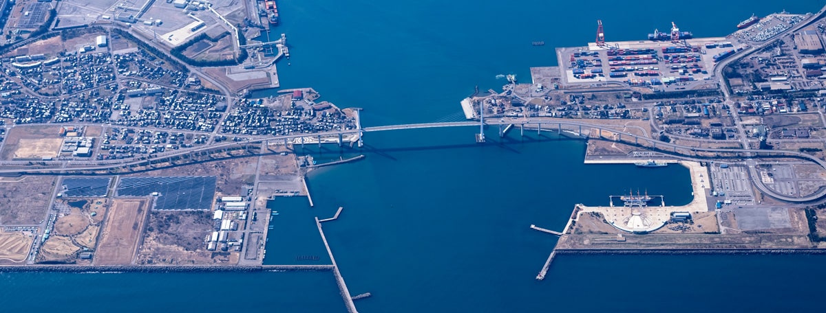
Harbor side line "Toyama new port East-West line"
Scheme drawing of "Harbor side line, Toyama new port East-West line"
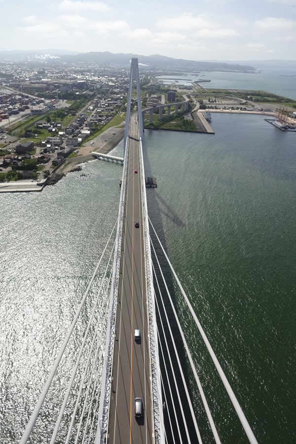
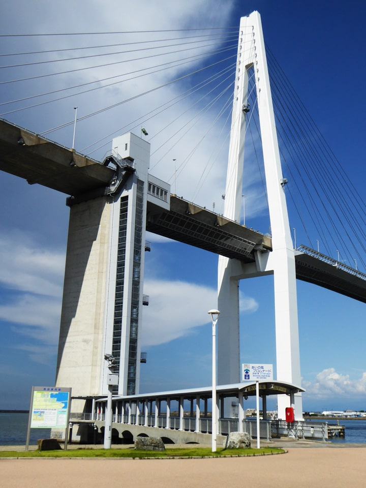
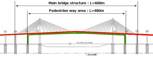
Side view of the Main bridge structure
Project Overview
Harbor side line “Toyama new port East-West line" was built in the Harbor facility furnishing plan 1986 as harbor side road connecting east and west port areas where were divided into parts along with the opening of Toyama New Port based on the fundamental policy of traffic-distribution reformation of the divided area, comprehensive function reorganization of Fushiki-Toyama 3 ports (Fushiki port, Toyama New port and Toyama port) and activation of the ports as passenger transportation and cargo distribution harbor.
Basic Specifications
| Total extension | Approx. 3,600m (Main bridge structure 600m) |
|---|---|
| Route | Harbor side line, North route (west side)-National road No.415 (east side) |
| Design speed | 50km per hour |
| Maximum longitudinal slope | 4% |
| Number of lanes | 2 lanes (width 3.5m × 2 lanes with shoulder belt area of 1.25m width) |
| Type of the main bridge section | 5-span continuous composite cable-stayed bridge |
| Main bridge structure | Steel beam for center span, PC beam for side span areas |
| Under clearance | Maximum height above water surface 47m |
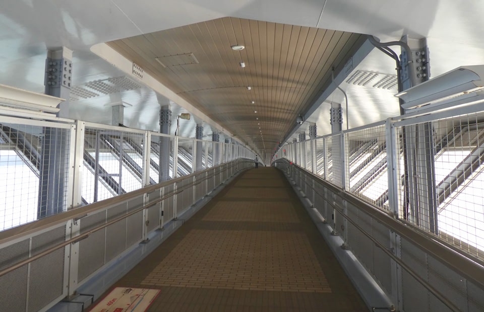
| Bicycle and pedestrian passage | All weather resistant type (Installed below the roadway of port entrance section) |
Pictures